
Fresh Water Diversion
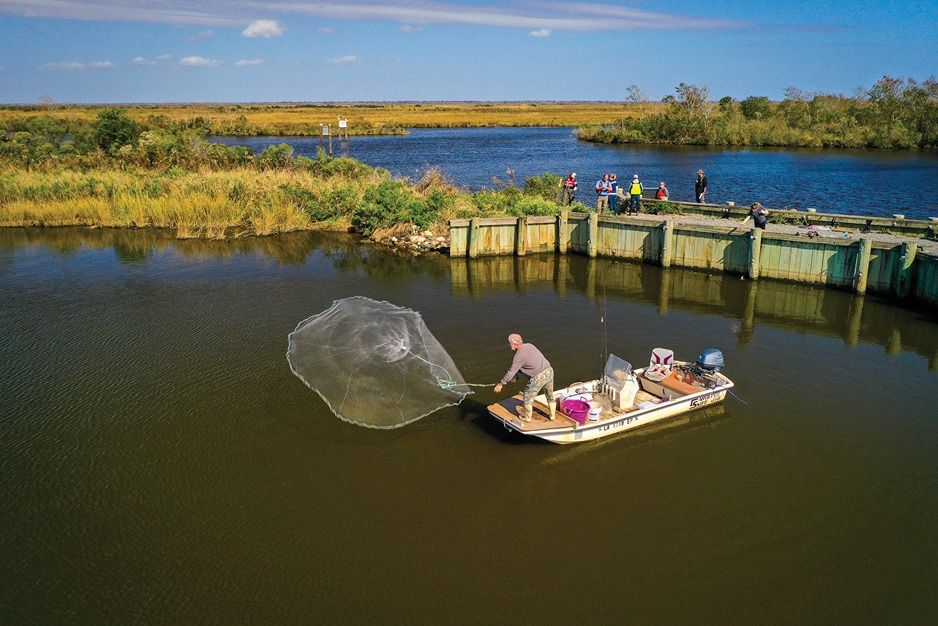
As insurance companies increase premiums or simply drop policies due to the increasing frequency of hurricane damage and the residents of Isle de Jean move to higher ground, it's apparent that our coastal communities are in imminent danger.
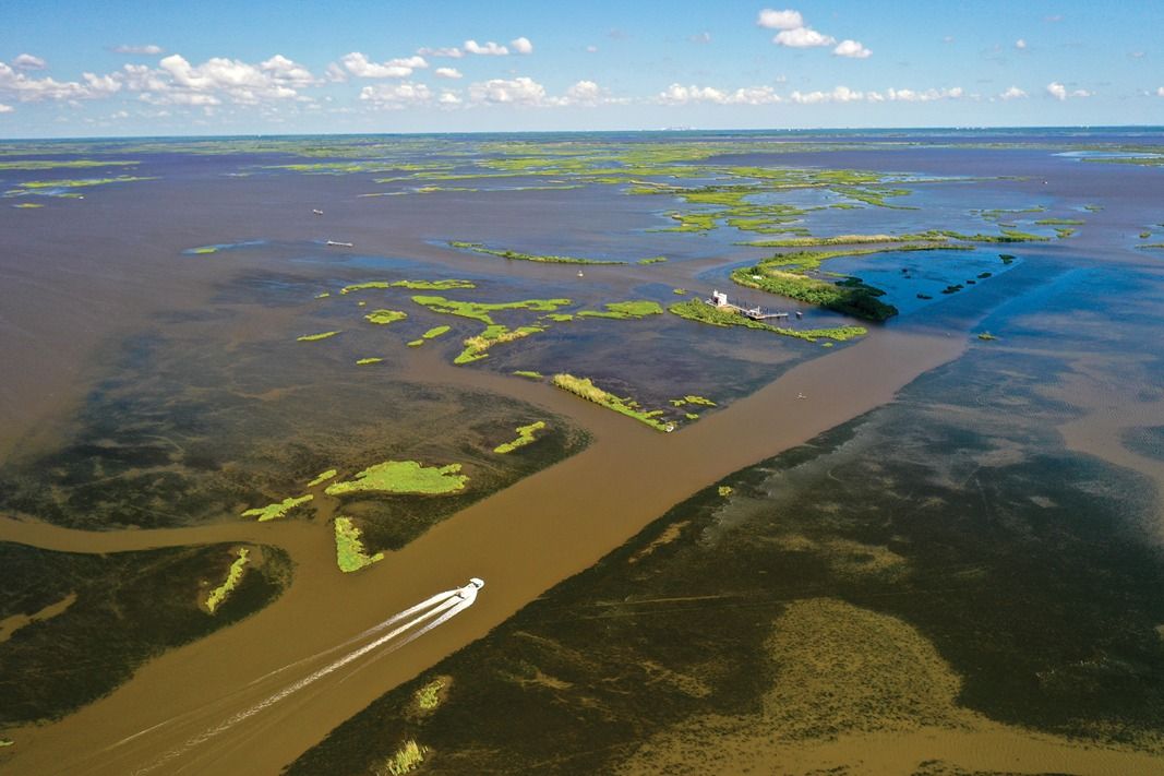
Historically, the Mississippi River would periodically overflow its banks. The flooding pushed rich sediment over the floodplains that eventually built land, created waterways, and created diverse ecosystems. This nutrient-dense land was excellent for growing crops. Levees built by people who started settling alongside the river and in its floodplains in the 1800s attempted to restrain the river to the detriment of the southern portion of the state. Slowly but steadily, water crept over Louisiana's coastal lands over the course of the last two centuries.
Though some people, organizations, and communities grew concerned about the erosion, plans for how to mitigate the loss were not considered urgent until the onslaught of Hurricane Katrina in 2005. That ruinous storm ushered in the Coastal Master Plan in 2007, which was created and maintained by the Coastal Protection & Restoration Authority. The organization works with the U.S. Army Corps of Engineers, state and local officials, and the public to identify and prioritize issues affecting our coast and put forth projects that could help with those issues.
The 2023 Coastal Master Plan Draft is the fourth revision of the original plan. Since that time, there have been several devastating hurricanes across Louisiana's coast and the Deepwater Horizon Oil Spill that brought destruction as well as more federal and corporate dollars that have allowed the Master Plan to scale up. In the latest iteration of the Master Plan Draft, the CPRA boasted that they have "completed more than 140 projects," which have restored 71.6 miles of barrier islands, improved 369 miles of levees, used dredged sediment to build land and marsh, and restored oyster reefs. Yet, there is much to be done to slow the mass erosion. Disagreements about how to accomplish the Master Plan goals, however, have led to stalemates.
Some of the proposed projects in the Master Plan are highly controversial and are debated by citizens, city and parish councils, activist organizations, and government officials to the point of halting projects altogether. Sedimentary diversions in the Barataria and Breton regions may have broken ground by now, but the use of diversions has been contested by some citizens and businesses who may suffer losses from them.
As some high-profile projects have been tabled, one large-scale project has finally started construction to the relief of the hundreds of thousands of people it may protect from storm surge during hurricanes.
Project to Protect the Coast
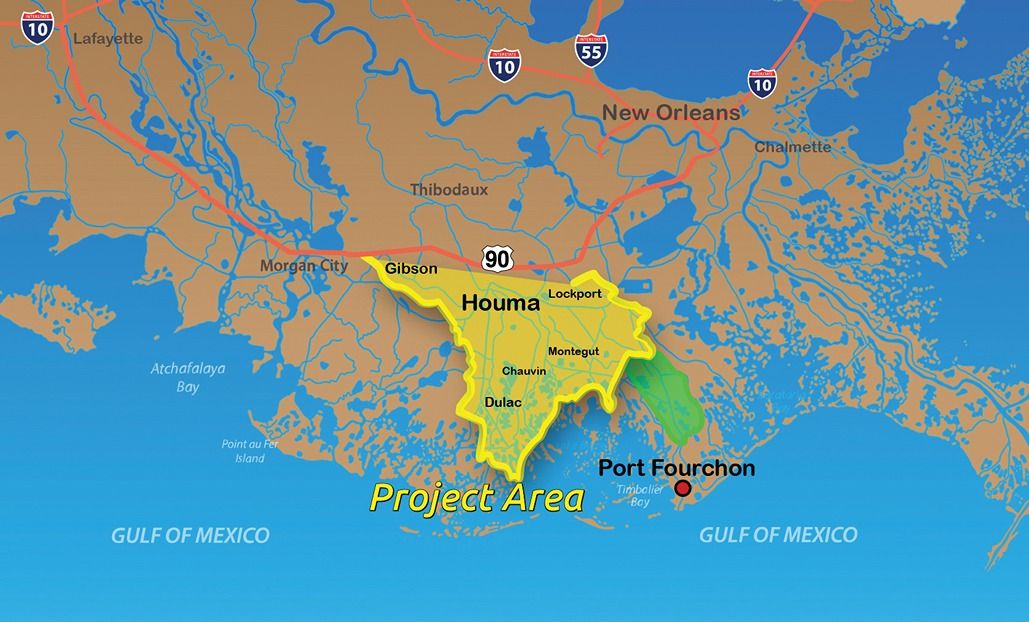
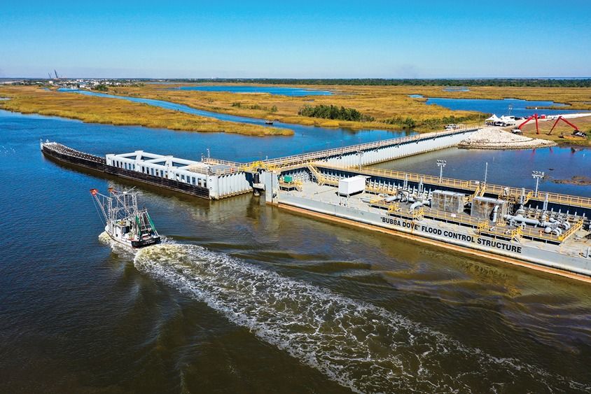
The Morganza-to-the-Gulf Hurricane Protection System is a storm damage risk reduction project. "The project is a 98-mile alignment consisting of earthen levees, floodgates, environmental water control structures, road/railroad gates, and fronting protection for existing pump stations," explained the Army Corps of Engineers (USACE). The massive endeavor hopes to provide protection from hurricanes up to Category 3 for coastal Terrebonne and Lafourche Parishes, about 60 miles southwest of New Orleans.
The USACE further explained, "The project would reduce the risk of flooding due to storm surge more than 52,000 structures and over 200,000 people in an area of intense concentration of energy infrastructure near the confluence of two nationally-significant navigation corridors in the Mississippi River and the Gulf Intercoastal Water Way. Deterioration of coastal marshes as a result of saltwater intrusion, land subsidence, and the lack of interchanges from the Mississippi River and tributaries system have steadily increased vulnerability to storm surge inundation over time."
The Morganza-to-the-Gulf was originally authorized in the Water Resources Development Act of 2007, but it was redesigned before it got started, triggering a long series of approvals which took years to do. The first part of the project, the Humble Canal Floodgate, received $12.46 million in funding from the Consolidated Appropriations Act of 2021 to develop a Project Partnership Agreement, start construction of the Humble Canal Floodgate Preload, and work on any extra design for the Humble Canal. About $400 million has been allocated for the entire Morganza-to-the-Gulf.
Putting the Plan into Motion
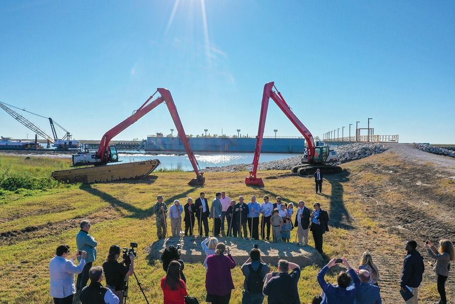
On December 9, 2022, the groundbreaking ceremony for the Humble Canal Floodgate foundation in Montegut was held. Col. Stephen Murphy of the United States Army Corps of Engineers stated, "This day has been many years in the making and we are thankful to all those before us who worked to make it possible. This is an important step toward furthering one of our nation's most important risk reduction systems."
The foundation for the floodgate will take about 8 months to complete, and the floodgate will be started in 2025. There is a floodgate in this area already that was built in the 1990s, but it can take hours to raise and lower, whereas the new one will take only a handful of minutes.
While this may seem underwhelming, the fact that other potential coastline-saving and land-building projects have not been able to go through for several years means that land is continually being lost forcing wildlife to find new habitats. This, in turn, makes citizens wonder if they need to abandon their homes for higher ground. Unfortunately, even if all of the projects in the Master Plan began immediately, Louisiana will continue to weather the impacts of erosion.

The Coastal Master Plan 2023 Draft states, "Since 1932, more than 2,000 square miles of Louisiana's coast, and the benefits they provide, have been lost. Even with the 2023 Coastal Master Plan fully implemented, coastal Louisiana's landscape is going to look different 50 years into the future. We see a maximum benefit of 395 square miles of additional land [created] at Year 40, however, the benefits of many of the early projects diminish in the final decade as they can no longer keep pace with subsidence and accelerated rates of sea level rise."
Stay Informed on LA's Coastal Erosion
You can keep up with coastal erosion matters and projects, including finding public hearing events, at coastal.la.gov and crcl.org.